Intelligent public transport systems: The future of mass transit
With the global rise in urbanization, cities need increasingly reliable, smart, and efficient transportation systems. But what are the technologies that make a transport system intelligent? And who stands to gain the most from these systems in the future?
Making the city smart
As economies around the globe expand at an unprecedented rate, this growth goes hand- in-hand with urbanization. According to the United Nations, by 2050, around 70% of the world’s population is expected to be living in urban areas – an additional 2.5 billion city dwellers. This will place a further strain on mass transit in the future: it is predicted that the number of passengers traveling in towns and cities will triple over the same period. To meet these challenges, whether now or in the future, urban areas need an intelligent public transport system (IPTS).
An IPTS provides the transit manager and passengers with up-to-date information about journey, vehicle and network conditions. To do this, IPTSs rely on modern technologies for capturing data from different parts of the transportation network, such as vehicle location, messages, alerts, and videos, and for exchanging this data between the various connected components.
Not only does an IPTS play an immediate role within an urban context by streamlining operations, when coupled with artificial intelligence (AI) it helps shape the future of smart cities. The constant analysis of the data collected, such as passenger numbers, allows for virtual modeling of public transportation networks in years to come. Moreover, adding this real-time data to other information gathered from the Internet of Things (IoT), especially in cloud-based networks, leads to such phenomena as the predictive maintenance of railcar doors, for example, resulting in greater availability.
The development and implementation of IPTSs thus improves the quality of service among public transportation networks, making the use of mass transit in cities more attractive. Alongside reducing congestion and pollution, the increased ridership means more revenue for transport authorities.
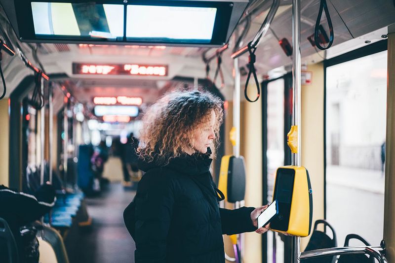
What are the main components of an intelligent system?
An IPTS is comprised of several of today’s most innovative technologies, each responsible for a certain task within the network. In general, these are:
- Automatic Vehicle Location (AVL) Systems
- Automatic Passenger Counting (APC) Systems
- Decision Support Systems (DSS)
- Passenger Information Systems (PIS)
- Geographic Information Systems (GIS)
Each system provides the operator with various data on the state of the network, which can automatically be sent as an alert to passengers, or used later for redesigning bus routes, for instance.
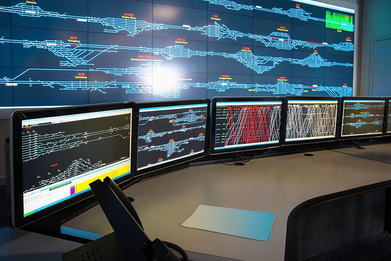
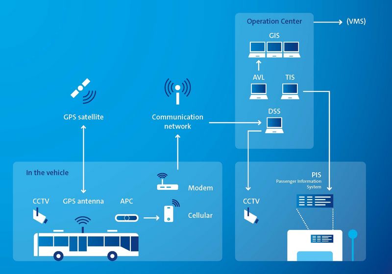
To begin with, AVL systems provide operators with real-time information about their vehicles, such as speed and direction, as well as about delays due to disturbances such as traffic congestion, bad weather, or road construction. The data provided by AVLs not only allows timetables to be updated in real time, it can also be used to make predictions about the state of the vehicles.
En route, APC systems record the number of passengers boarding and alighting at each stop. Because APC systems provide the foundation for occupancy data in real-time, an increasing number of transit agencies are providing this information to their passengers. Especially during the current pandemic, this data allows passengers to plan their trips and alter their travel habits accordingly. Similarly, APC systems enable transit authorities to adjust schedules in response to drastic changes in ridership numbers as a result of the pandemic. Today, advanced sensor technologies are being used to develop more efficient APC, including 3D computer imaging based on intelligent image detection systems to recognize and count passengers as they board and alight.
When, inevitably, unexpected events occur, DSS assist operators in controlling the transportation network by suggesting alternative strategies. DSS analyze incoming data from AVL and APC systems to detect serious delays. The DSS then offer appropriate control decisions and regulation strategies to bridge the gap until the normal schedule can be resumed.
This real-time data is fed into the PIS, which updates passengers on current operating conditions, notably arrival and departure times. The first generation of PIS uses Variable Message Signs (VMS) at stations, while today’s advanced Traveler Information Systems (TIS) send data about traffic conditions, route guidance, and journey information via the internet straight to the passengers’ mobile phones.
Lastly, the main task of a GIS is to process the data collected by tracking systems, such as GPS or Galileo. This then allows real-time mapping of vehicles along their routes to analyze traffic flow, as well as localizing disturbances within the transportation network. Over the past few decades, research has focused on using GIS technology to automate the route planning process.
All of these systems collect, process, and exchange different types of data provided by various detection devices and advanced technologies, such as satellites and smart sensors. The IPTS combines the data from these various connected technologies to compose a holistic picture of the entire operation.
Mobile communication – how does all this data reach the user?
In general, an IPTS can be divided into three layers according to the basic concept of the IoT: a perception layer, a network layer, and an application layer.
The first of these, the perception layer, is the information source and collects data from multiple devices within the system. These may be:
- Passenger devices (including cell phones, and season tickets)
- On-board devices (such as AVL, APC, and video cameras)
- Devices at the stops, (including automatic vehicle identification and video cameras)
- Roadside devices, (such as signaling and smart lampposts)
- Vehicle crew devices, (including RFID tags and ticketing devices)
The intermediate network layer is responsible for transmitting the information from the perception to the application layer. It makes use of wired and wireless public communication, such as GSM, GPRS, CDMA, 3G, 4G or 5G, for transmitting data over relatively long distances. This transmission is supplemented by private wireless communications, including RFID, Wi-Fi and Bluetooth, for connecting smart sensors to terminals installed in vehicles or at stops.
The third layer, the application layer, processes the data received from the perception layer and provides applications for both the transit agency and passengers of the transportation system. For agencies, this might be a task assignment application or for public safety announcements. From the passenger perspective, these apps may include traffic information, timetable queries, or traveler guidance.
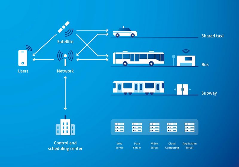
The IoT – How cloud computing makes an intelligent public transport system even smarter
With the support of cloud computing, data-mining algorithms, for example, can be used to find the regular characteristics of network flow and thus optimize the overall efficiency of the transportation system.
The real-time data collected by an IPTS from the IoT devices, including wait times at stations, passenger counts, vehicle tracking, etc., is combined with information taken from the internet, such as sporting events, weather forecasts, or public notices. Those details are then sent to the central vehicle monitoring and control center for storage and processing.
In addition, historical data is further analyzed to extract useful patterns or rules, such as evening peaks at particular stops. This analysis allows for passenger flow and vehicle arrival times to be calculated based on forecasts generated by previous patterns and real-time information.
As a result, an IPTS can assist transit managers in optimizing their resources, improving overall scheduling, and reducing passengers' travel time.
Where are these smart solutions in action?
Several mass transit authorities around the world have implemented IPTS to ensure a high quality of service for their passengers. For example, more than 120 operators in the USA already benefit from these systems, with Geographic Information and Decision Support Systems being the most widely used technologies.
One European example is Lahti, in Finland, which has initiated the CitiCAP project that focuses on enabling and promoting sustainable urban mobility to reduce traffic congestion and CO2 emission. iris is partnering with the local company, Mattersoft, to monitor passenger flows using Automatic Passenger Counters and gather comprehensive data on people's mobility choices. The personal carbon footprint is calculated depending on the transport mode selected, as registered by a new mobile app. Through the PCT scheme Lahti citizens can receive benefits, such as discounted bus tickets or bicycle repair services, in exchange for their smart mobility choices. At the same time, the information serves as a tool for urban planners as well as being a source of mobility data for innovators.
So, in the end, everyone benefits.
This might also interest you:
Contact us for more details
We are here for you
General request
For general inquiries please call us
You can reach us from Mon - Fri, 08:00 - 16:00 (CET)


